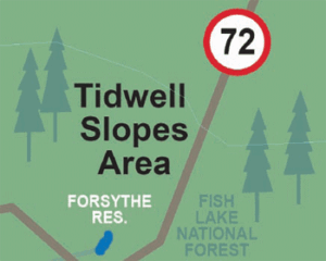
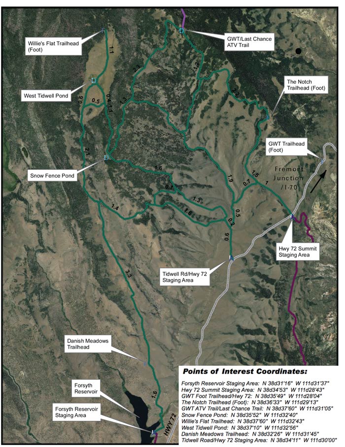
The staging is located at the Forsyth Reservoir just outside Loa.
TRAIL TYPE
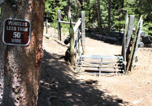
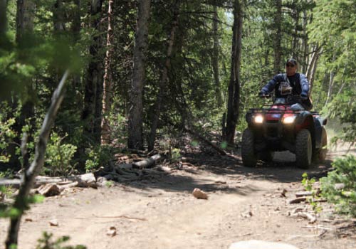
Road passable only to ATV or Jeep. Some trails that connect with the GWT have 50” restrictions.
DISTANCE
The length of this trail varies, depending on what path you choose to do. Keep in mind the size restrictions of the vehicle for certain parts of the trail.
DIFFICULTY
MODERATE – Some parts are a little more difficult than others, but it is passable through the whole trail.
EQUIPMENT This trail has been designed for ATV, and Jeep. 50” restrictions.
ENVIRONMENT This trail is open year round. The best times to do the trail are spring and fall.
SAFETY Be sure to have the proper equipment for any potential weather changes in the forcast.
TRAIL TIP Take some time to explore the spur trails. There are many interesting and beautiful sites to see so make the most of your excursion and try to fit a couple in!
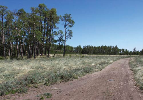
The Tidwell Slopes are a series of hills and grassy valleys that are frequently used for summer cattle grazing. Deer and Elk are quite plentiful in this area and may be most visible in early morning and late evenings. The hills offer large patches of open spaces and groves of aspen, pine, and spruce.
Get a Closer Look
There are several inner or outside trails that can be explored. The Great Western Trail connects at the north end of Tidwell Slopes and follows the northeastern edge toward the Geyser Peak trail which is also part of the Great Western Trail.
Do it at Your Own Pace
5.9 Miles – Hwy 72 Summit Staging Area to GWT/Last Chance Trail 7.6 Miles – Forsyth Reservoir Staging Area to West Tidwell Pond 3.6 Miles – Snow Fence Pond to GWT/Last Chance Trail 5.4 Miles – Tidwell Rd/Hwy 72 Staging Area to GWT/Last Chance Trail 6.3 Miles – Tidwell Rd/Hwy 72 Staging Area to Willie’s Flat Trailhead 8.7 Miles – Forsyth Reservoir Staging Area to Willie’s Flat Trailhead 12.2 Miles – Forsyth Reservoir Staging Area to GWT/Last Chance Trail