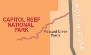
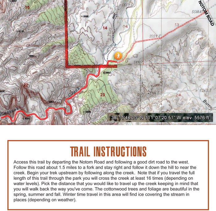
This trail is located off Notom Rd. 6 mi. south of Hwy 24.
TRAIL TYPE
This trail is for hiking only. There are ample opportunities to venture into alcoves, slot canyons, or narrow side canyons.
DISTANCE
The total distance for this trail is 7.6 miles. This includes hiking in and back out.
DIFFICULTY
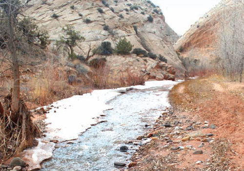
EASY – There are some stream crossings that make this trail a little more challenging in some parts, but definitely easier than the other slot canyons.
TRAIL DESCRIPTION
This trail will have you jumping from rock to rock or wading through calf-deep streams.
EQUIPMENT This trail is for hikers only. Make sure you are prepared with the proper equipment.
ENVIRONMENT Although this trail is beautiful all year round, the best times to hike it are in the late spring, summer or early fall.
SAFETY Make sure to check the weather reports before starting this trail, as rain will cause this trail to be more difficult and dangerous.
TRAIL TIP It would be very handy to have a walking stick especially when you are going through the stream crossings. A walking stick will help with balance and help you keep your footing.
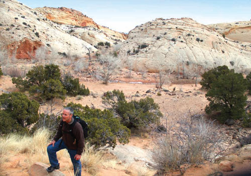
Like Burro Wash, Pleasant Creek has its own array of white stone. It is unique though, because of the mixture of Red Rock and the Navajo Sandstone. This mixture of red and white creates a beautiful view for any traveler.
Get a Closer Look
The cottonwood trees that line the creek bed will provide a beautiful accent to the meandering trail and white sandstone formations. Along the way you will have opportunities to leave the trail and ascend the rock slopes on either side of the creek. These elevated areas will provide long views in all directions.