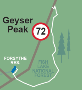
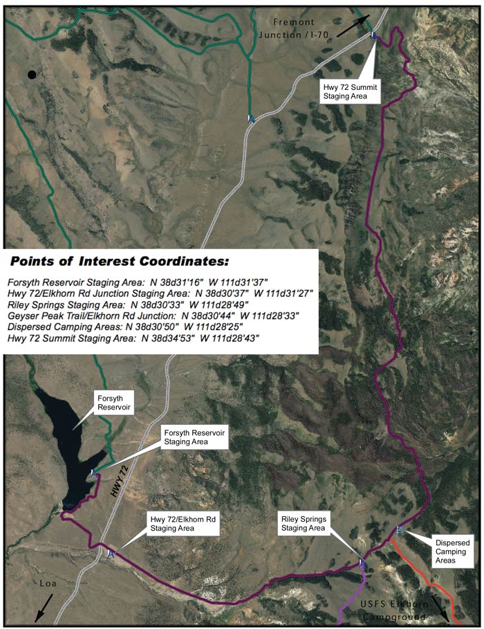
This trail can begin just off Highway 72 at Forsyth Reservoir (west side) or three miles up the road east from Forsyth Reservoir where there is also a trail head at Riley Springs.
TRAIL TYPE
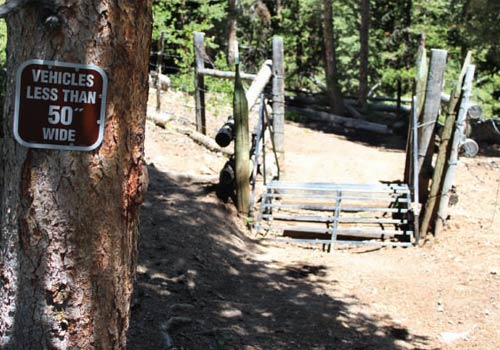
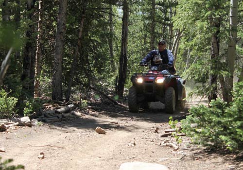
This trail is for ATV. Some areas have 50” restrictions.
DISTANCE
This trail is just under 11 miles long.
DIFFICULTY
EASY – This trail is relatively easy. Some parts of the trail are al little more difficult, but can be done.
TRAIL DESCRIPTION
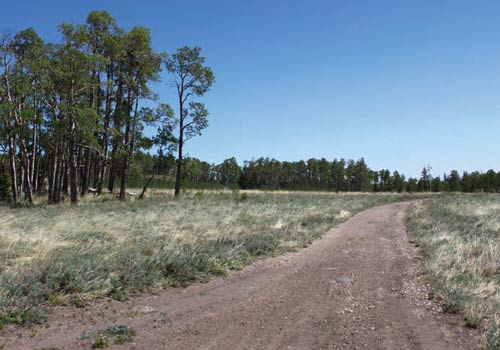
This trail is mostly a maintained dirt trail. Some parts of the path are more rocky than others, but can still be easily negotiated.
As you bend to the north you pass several areas where you can enjoy views into the east of Cathedral Valley, and further northeast toward the San Rafael Swell. Views go east over the Dirty Devil River and Canyonlands National Park, as the Manti La Sal Mountains near Moab. The trail descends into a long scenic valley before ascending again and turning west to Highway 72.
Get a Closer Look
As you follow the road east below Geyser Peak and it will wrap north around the peak. On this trail you’ll pass through beautiful alpine forest areas of junipers, aspen, pine, and spruce.
Do it at Your Own Pace
You can either return on this trail to the trail head or you can loop back by including the Tidwell Slopes trails on the west side of Highway 72. Their are optional trails that lead south from Riley Springs to Pole Canyon (2 miles) and Elkhorn Campground (4 miles) along the northern rim of Thousand Lakes Mountain. (50″ width limitations)