 Winter hikes are hard to come by in some areas of the country where the snow is flying regularly, but around Hanksville, Utah the snow comes more rarely, and daytime temperatures in winter can be nearly perfect for hiking.
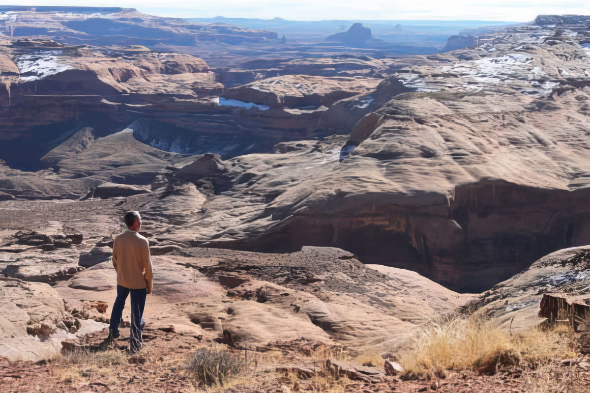
That’s where the Dirty Devil River and Angel Point come into play. Angel Point is accessed south of Hanksville, Utah on Highway 95 which leads toward Hite Crossing at the Colorado River, and toward highway 276 and Bullfrog Marina at Lake Powell. View the location of Angel Point on Google Map.
To access Angel Point you will turn left off of Highway 95 and follow a well graded dirt road. See this detailed map below, and get more details on this location – HERE.
What to do at Angel Point: You can move along the rim for various overlook views of the Dirty Devil River basin or you can descend a trail at Angel Point that leads to the Dirty Devil River and ascends the canyon on the east side.
As always, come prepared with plenty of water, food, and other supplies that would be needed to enjoy a good viewing or hiking experience. This is some of Utah’s must rugged country and Butch Cassidy and other outlaws used the Dirty Devil River region as one of their favorite hide-outs. Robber’s Roost, perhaps the most famous hide-out is found north and east of Angel Point and can be accessed via roads that come in on the east side of the Dirty Devil.
Find more information – HERE
Keep Capitol Reef Country Forever Mighty
What is Forever Mighty? It’s practicing responsible travel while visiting Utah and Capitol Reef Country by following the principles of Tread Lightly and Leave No Trace.
Plan ahead and prepare, travel and camp on durable surfaces, dispose of waste properly, leave what you find, minimize campfire impacts, respect wildlife, be considerate of others, support local business and honor community, history and heritage. Help us keep Utah and Capitol Reef Country’s outdoor recreation areas beautiful, healthy, and accessible.