CAPITOL REEF NATIONAL PARK
Capitol Reef National Park lies in Utah’s south-central desert, an oasis of colorful sandstone cliffs, impressive domes, and soaring monoliths. Once called “Wayne Wonderland,” the park got its name in part from the great white rock formations which resemble the U.S. Capitol building, and from the sheer cliffs that presented a barrier to early travelers. Early inhabitants referred to the area as the “land of the sleeping rainbow” because of its beautiful contrasts: multi-colored sandstone surrounded by verdant riverbanks and arid desert vegetation, all nestled beneath deep blue skies. The area was designated as a national monument in 1937 and reclassified as a national park in 1971. The park is open year-round. See the Capitol Reef National Park official map and trails for more information.
GEOLOGY
The Waterpocket Fold defines Capitol Reef National Park. A nearly 100-mile long warp in the Earth’s crust, the Waterpocket Fold is a classic monocline: a regional fold with one very steep side in an area of otherwise nearly horizontal layers. A monocline is a “step-up” in Waterpocket Fold the rock layers. The layers on the west side of the Waterpocket Fold have been lifted more than 7000 feet higher than the layers on the east. Major folds are almost always associated with underlying faults.
The Waterpocket Fold formed between 50 and 70 million years ago when a major mountain building event in western North America, the Laramide Orogeny, reactivated an ancient buried fault. When the fault moved, the overlying rock layers were draped above the fault and formed a monocline. More recent uplift of the entire Colorado Plateau and the resulting erosion has exposed this fold at the surface only within the last 15 to 20 million years. The name Waterpocket Fold reflects this ongoing erosion of the rock layers. “Waterpockets” are basins that form in many of the sandstone layers as they are eroded by water. These basins are common throughout the fold, thus giving it the name “Waterpocket Fold”. Erosion of the tilted rock layers continues today forming colorful cliffs, massive domes, soaring spires, stark monoliths, twisting canyons, and graceful arches.
SLOT CANYONS
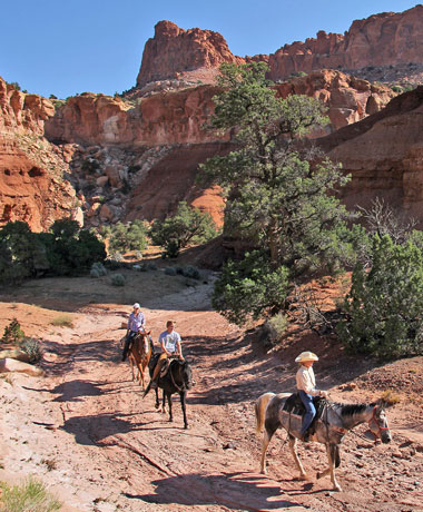
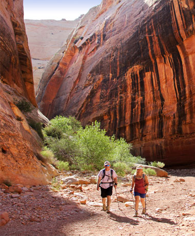
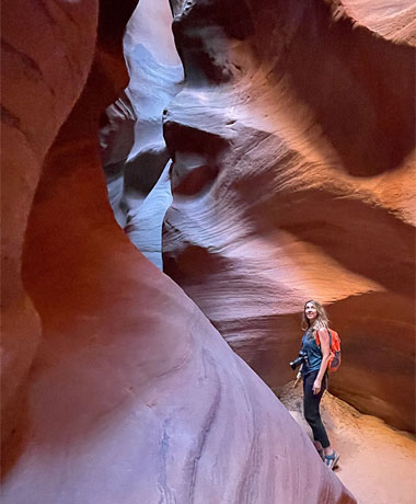
Slot canyons or “narrows” are fairly common throughout Capitol Reef Country. They sometimes begin very high up in the cliffs and flow out to the lower valleys or sometimes stay relatively level and cut completely through the standing rock. Winding and twisting through solid sandstone, these canyons could fit a car or barely fit a person standing sideways. It is easy to forget that these beautiful narrow passageways are extremely dangerous. Flash floods from miles away send muddy red water shooting down the slot at incredible speeds. When hiking the narrows, always pay attention to the weather, and leave notice of which canyon you are hiking and when you should return.
NIGHT SKIES
Did you know two-thirds of the U.S. population and one-fifth of the world population can no longer see the Milky Way in the night sky! Capitol Reef National Park is considered to have one of, if not the darkest night sky of any national park in the United States.
ACCESS
The gateway town of Torrey is just eight miles west of Capitol Reef National Park’s visitor center, on Highway 24. The town offers lodging and restaurants, and easy access to the scenic wonders inside the park. Other neighboring communities on the west side of Capitol Reef, such as Grover, Teasdale, Bicknell, Lyman and Loa, also make great staging areas for exploration of this national park. Entering from Torrey offers a view of the Waterfold Pocket. Caineville and Hanksville are located on the east side of Capitol Reef, also on Highway 24, and both communities make great locations from which to view Capitol Reef or other nearby attractions such as Canyonlands National Park, Goblin Valley State Park and more.
ROADS
- From Torrey, Highway 24 continues east through the park, offering access to landmarks such as Chimney Rock, Capitol Dome, Hickman Bridge, the Fremont Petroglyphs, and Behunin Cabin.
- The 8-mile (one way) long Scenic Drive begins near the visitor center off Highway 24 and heads south past the Gifford Farmhouse and Fruita. Along Scenic Drive there are two spur roads which offer spectacular backcountry access.
- Grand Wash Road is a one-mile, well-maintained dirt road that leads to Cassidy Arch. Further south, the 2.5-mile roundtrip Capitol Gorge Road gives access to Capitol Gorge Trail, a one-mile stretch that leads to Pioneer Register.
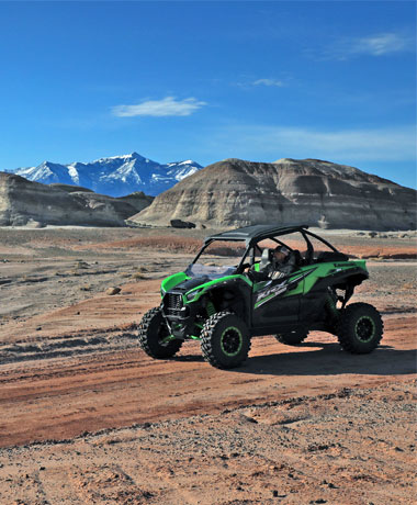
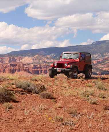
- There are also hundreds of miles of unpaved roads leading into the backcountry, including the Cathedral Valley Loop, a 70-mile scenic drive through Cathedral Valley, which requires a high-clearance, four-wheel drive vehicle.
THINGS TO DO IN CAPITOL REEF
The summer season at Capitol Reef National Park will kick-off in late May with activities, presentations and extended visitor center hours. The Visitor Center will be open from 8:00 AM to 6:00 PM daily beginning late May. The historic Gifford Farmhouse is open every day from 8:00 AM until 5:00 PM. A regular schedule of daily ranger-led interpretive services and programs will begin in late May and will continue throughout the summer. The historic Fruita schoolhouse will be open from 10:00 to 11:30 AM. Geology talks will be offered in the visitor center at 10:50 AM and 1:50 PM.
Ranger programs will be given at the petroglyph panel on Highway 24 at 3:00 PM. A ranger-guided walk will be available daily. Check at Visitor Center for schedule. Programs at the campground amphitheater will be held nightly. Times and topics will be posted at the Visitor Center and on campground bulletin boards. Special programs at the Gifford House and the Ripple Rock Nature Center are planned throughout the summer season. All programs and events are free of charge and open to the general public. For more information, call the park visitor center at 435-425-3791 extension 111.
POINTS OF INTEREST
The most distinguishing geologic feature within the park is the 100-mile long Waterpocket Fold, a protuberance in the earth’s crust that has eroded into a maze of winding canyons, towering monoliths, and massive domes.
- Capitol Dome: A majestic white sandstone formation that resembles the U.S. Capitol building. The park was partly named for this landmark.
- Chimney Rock: A towering 400-foot-tall sandstone pillar, located three miles west of the visitor center off Highway 24 and accessible via a short hiking trail.
- Hickman Bridge: A huge natural arch spanning 133 feet wide and 125 feet tall. The arch is named after Joseph Hickman, an early advocate for Capitol Reef’s preservation.
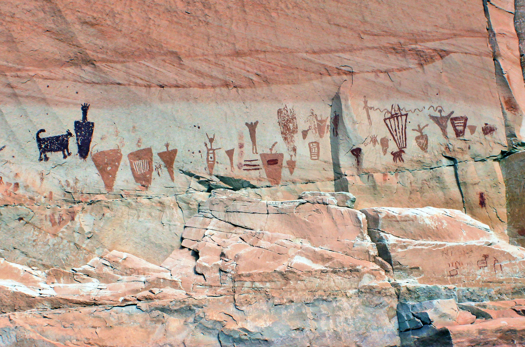
- The Fremont Petroglyphs: These petroglyphs were etched in sandstone by the Fremont people who inhabited the area nearly 1,000 years ago and can be seen from the Hickman Bridge Trail.
- Pioneer Register: Early Mormon pioneers also left their mark in Capitol Reef, carving their names in sandstone at Pioneer Register to acknowledge their travels.
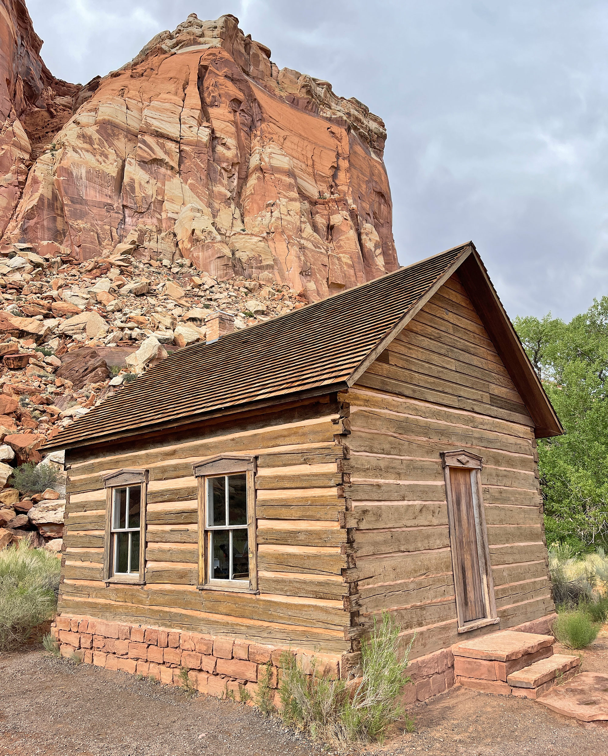
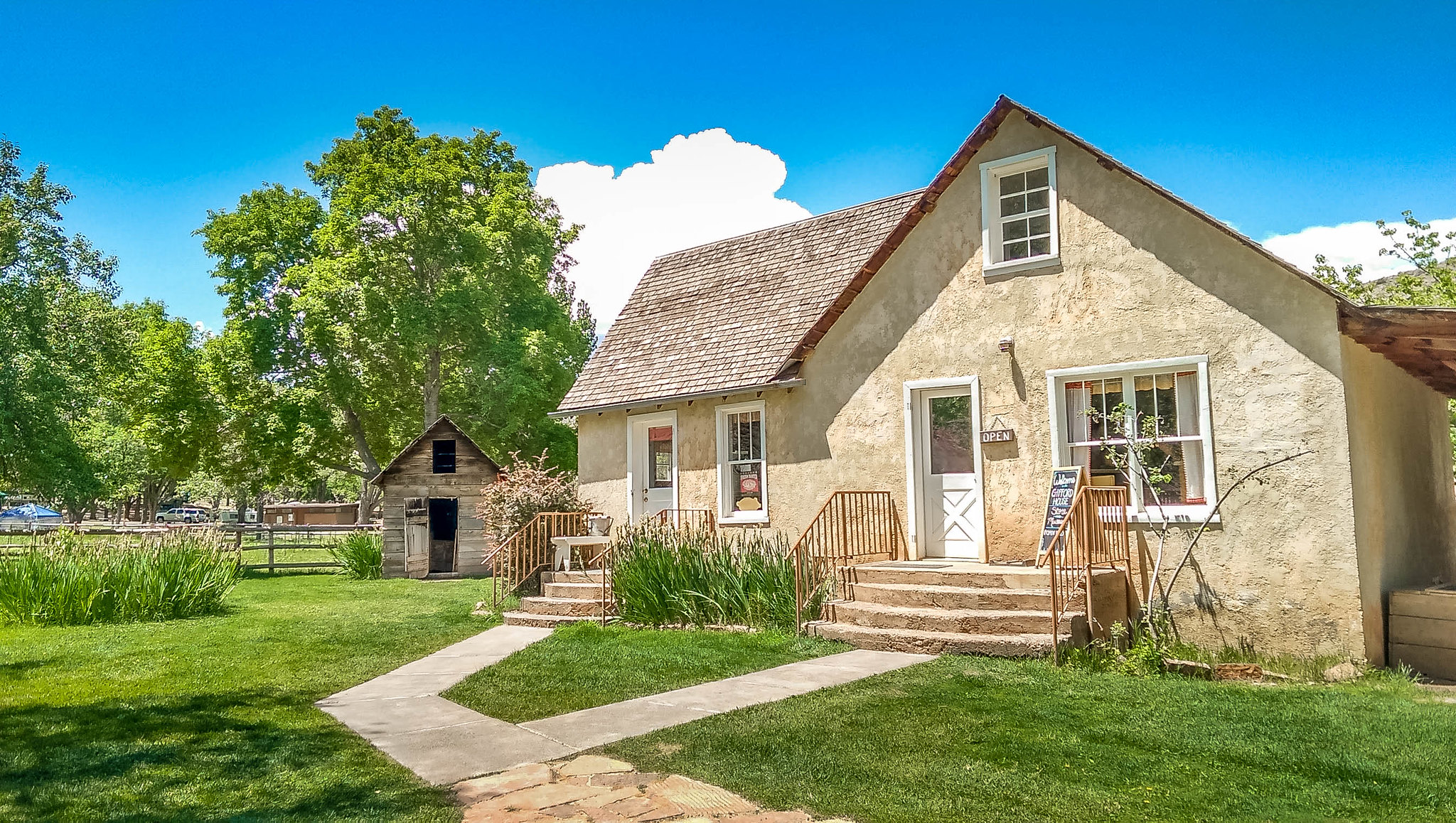
- Behunin Cabin: In 1882, Elijah Behunin built Behunin Cabin out of red sandstone to blend in with the surrounding landscape. The cabin remains can be seen just off of Highway 24 on the east side of the park. The historic Gifford Farmhouse, built in 1908, can be reached via a short path about a mile south of the visitor center.
- Fruita, Utah: The small town of Fruita inside the park has more than 2,500 fruit trees, some of which were originally planted by Mormon pioneers. Today the town is federally owned, and visitors can stroll through the orchards and eat fruit fresh off the trees.
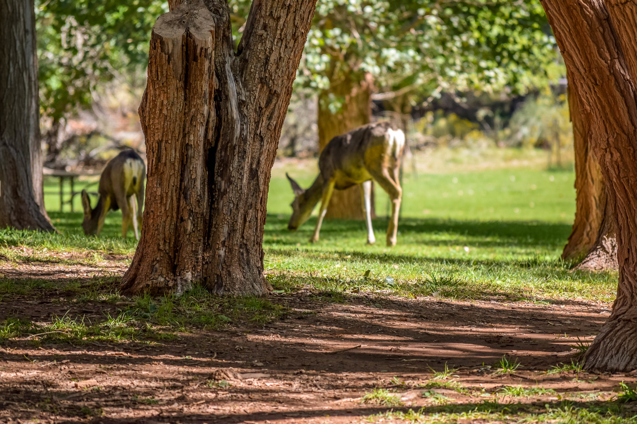
- The Gifford Homestead: In the heart of the Fruita Valley, one mile south of the Capitol Reef National Park visitor center is the Gifford Homestead. Here you can have a picnic, observe wildlife (deer often hang around), visit farm animals, relax, explore, or try one of Fruita’s famous and incredibly delicious fruit pies. The Gifford House usually operates from Mid-march til early November. This shop offers a variety of local and handmade products: quilts, aprons, woven rugs, soap, candles, books, jams, sauces, and of course the fresh baked fruit pies and homemade ice cream.
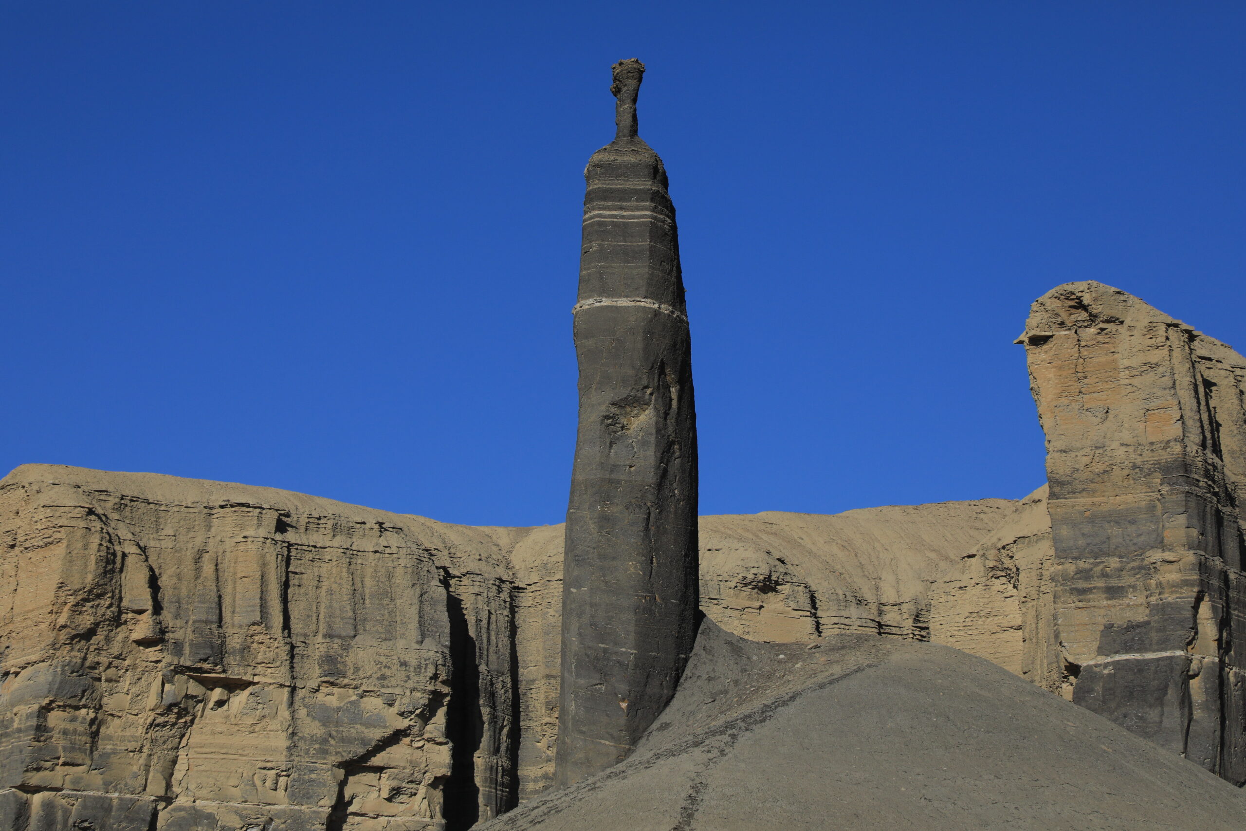
- Cathedral Valley: A remote area in the northern end of the park where enormous monoliths soar hundreds of feet high.
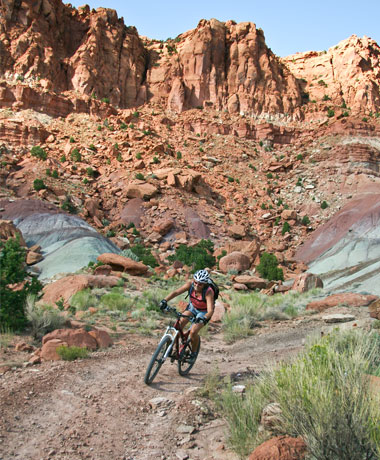
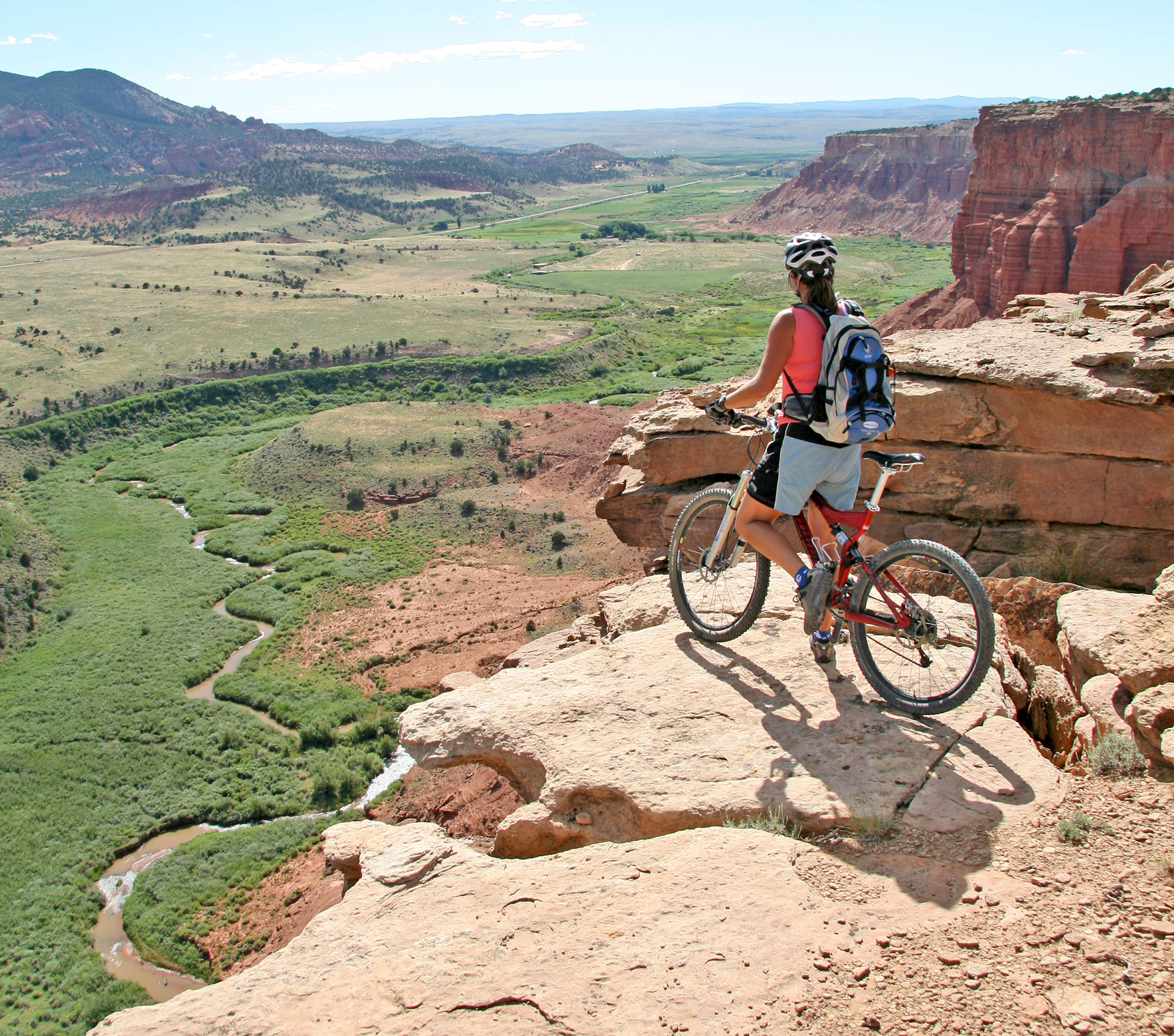
HIKING IN CAPITOL REEF NATIONAL PARK
Utah’s Capitol Reef National Park is filled with a diverse and stunning variety of landscapes and trails. Many trails offer variations and combinations, each with something special to offer. Be sure to check out our blog posts below that go into greater detail about many of these hikes and hiking in Capitol Reef National Park.
Hickman Bridge Trail: A moderate 1.7 mile out-and-back trail with a 300 foot incline. The trailhead is two miles east of the visitor center on Highway 24. Hickman Natural Bridge, a massive natural sandstone arch formation that spans across a canyon is the crowning jewel of this hike.
Cassidy Arch Trail: Named after the famous Butch Cassidy this moderately challenging 3 mile out-and-back trail leads you to the beautiful Cassidy Arch and panoramic views of the park.
Capitol Gorge Trail: A moderate 4.5 mile out-and-back hike that takes you through a narrow canyon, past towering rock cliffs, and ancient petroglyphs. For more on Capitol Gorge Trail.
Sulphur Creek Trail: This moderate 5.5-mile trail is a popular choice for hikers of all ages and experience levels. Sulphur Creek highlights deep canyons, ancient rocks, opportunities for wading and swimming in the creek, canyoneering, waterfalls, rock scrambling and more.
Chimney Rock Trail: This moderate 3 mile loop with fairly steep elevation gain near the beginning offers fantastic views of Chimney Rock, a towering 400 foot sandstone pillar. The trailhead is three miles east of the visitor center off Highway 24 and accessible via a short hiking trail. It’s a great choice for capturing stunning photographs.
Grand Wash Trail: A flat easy hiking trail through towering rock walls and sandy washes that offers many variations (shuttle, out-and-back, adding Cassidy Arch Trail to Frying Pan to Cohab Canyon). The Grand Wash cuts through the upper portion of the Waterpocket Fold. It’s a peaceful, flat, scenic, and during certain times of the day shady hike. Spring is a great time to visit and enjoy the wildflowers.
Fruita Historic District Trails: Fruita has several short and easy trails that offer glimpses into the park’s agricultural history. The Fremont River Trail and Cohab Canyon Trail are popular options for exploring the beautiful orchards and historic buildings of the area.
Navajo Knobs Trail: This challenging 9.4 mile out-and-back trail takes you to the Navajo Knobs where hikers can enjoy panoramic views of the park and the Waterpocket Fold.
Cohab Canyon: A 3 mile out-and-back trail that sits on top of the Waterpocket Fold, overlooks Fruita, and later drops down into a gorge. This trail offers variation that connects to Frying Pan and onto Cassidy Arch and the Grand Wash.
Frying Pan: Is a challenging and beautiful 8.5 mile hike across a mesa and can be rather scorching in the heat of the summer. This hike begins/ends at either the Cohab Canyon Trailhead or the Grand Wash Trailhead.
Cathedral Valley: Cathedral Valley is a remote area within the park that requires high-clearance vehicles. It is incredibly stunning and unique highlighting monoliths, towering cathedrals, and incredible rock formations. The Cathedral Valley Loop Road is the way to explore this rugged and beautiful area.
Capitol Reef Scenic Drive is an incredible way to enjoy the variety of landscapes Capitol Reef National Park has to offer. There are numerous pullouts and viewpoints, allowing you to appreciate the stunning landscapes without much hiking
Capitol Reef National Park is a desert environment remember to check the trail conditions/weather, carry adequate water, wear appropriate footwear, and know your surroundings.
A Hiker’s Park Capitol Reef National Park is a treasure trove of many scenic trails from classic routes through washes to rim view overlooks. It’s also home to 20 plus natural arches, many having trails that lead to them including Hickman Bridge Natural Arch. With…
Hit the trails inside Capitol Reef National Park and walk in the footsteps of history’s most famous outlaws. The trails through the majestic Grand Wash and the spur trail to Cassidy Arch lead to some pretty unforgettable scenery as you explore the colorful canyon country. Combining the two…
With only two paved roads, UT-24 and the Scenic Drive, a large percentage of the park is accessible only by dirt roads and primitive trails. Most of this backcountry area is rarely visited by tourists since it requires getting off the beaten path and going to areas that often require…
A Can’t-Miss Beautiful Trail in The Center of Utah’s Mighty Five! While you’re out roaming through Capitol Reef National Park, the Sulphur Creek hike is one you can’t miss – it passes through some of the oldest rocks in Capitol Reef! These landforms are incredible to see, with several unique waterfalls that only add […]
Capitol Reef National Park, located in the center of Utah five national parks, is quickly becoming one of the state’s most popular destinations for hiking, sightseeing and other adventurous outdoor…
If you’re planning a family vacation to Capitol Reef National Park, you’re in for a treat. This prized park is one of Utah’s most captivating yet underrated destinations. Tucked away in the heart of red rock country, Capitol Reef National Park spans…
Are you an experienced hiker looking to make the most out of your next trip to Capitol Reef Country? If you have been hiking for years, then you…
There are only two paved roads within the park boundaries at Capitol Reef National Park; SR-24, which is the main road through the park, and the Scenic Drive. All other roads are either dirt or graded dirt. Of the five national parks in Utah, Capitol Reef is one of the most primitive, which makes it […]
Capitol Reef National Park is one of the larger parks in Utah covering miles of scenic and adventurous terrain that can best be seen and experienced in sections. One of these sections is Cathedral Valley located in the upper region of the park north of Highway 24. Much of Capitol…
WILDLIFE
The unique Waterpocket Fold has created diverse habitats that allow a wide range of plants and animals to flourish. More than 300 species reside here, including deer, antelope, ringtail raccoons, chipmunks and squirrels, golden Eagles, raven, bats, whiptail and collared lizards. Mountain lions, coyote, and black bear are rarely seen but also populate the area.
KNOW BEFORE YOU GO
IMPACT PRACTICES
- Know where you are allowed to camp.
- Tread lightly when traveling and leave no trace of your camping.
- Help keep Capitol Reef Country clean. If you pack it in – pack it out. Clean up after less thoughtful visitors.
- Camp away from isolated water sources.
- Teach children not to chase or interact with wildlife.
- Keep pets under control and know where they are and are not allowed.
- Leave historic sites, ruins, artifacts and rock art undisturbed for the future. Please report violations.
- Be respectful when you are in the back country
CAPITOL REEF VOCAB
Here are some terms and definitions you may encounter as you travel through Capitol Reef Country.
Mesa – a flat-topped hill with steep sides.
Plateau – a level expanse of elevated land.
Butte – An isolated, steep hill. Monument – the remaining hard rock center of an eroded Butte.
Bluff – a steep head land, river bank or cliff.
Bench – a long gradual series of hills.
Flat – an open level area, usually at higher altitude.
Draw – a shallow canyon or drainage. Wash – the dry bed of a stream.
Canyon – a narrow steep drainage.
Arroyo – a gully eroded by a stream.
Gulch – an arroyo.
Gorge – a large canyon.
Slot canyon – a very narrow canyon.
Petroglyph – rock art that is chipped or carved on a rock face.
Pictograph – rock art that is painted on a rock face.
Arch – a span of rock formed by the erosion of softer surrounding rock layers.
Natural bridge – an arch formed by and spanning a water course.
ALTITUDE SICKNESS
Anyone coming from lower altitudes to 6000 feet or more may complain of headache, unusual fatigue, nausea, loss of appetite, difficulty sleeping, and/or shortness of breath. This may be altitude sickness. The best treatment is: do not go up until the symptoms go down. Take it easy. Drink plenty of water. Avoid caffeine and alcohol. If symptoms persist consult a doctor and get to a lower altitude.
Plan Your Visit
Capitol Reef Country is filled with comfortable accommodations for every interest and budget.
NEARBY PARKS AND MONUMENTS
MORE ABOUT CAPITOL REEF
The summer season at Capitol Reef National Park will kick-off in late May with activities, presentations and extended visitor center hours.
- The Visitor Center will be open from 8:00 AM to 6:00 PM daily beginning late May.
- The historic Gifford Farmhouse is open every day from 8:00 AM until 5:00 PM. A regular schedule of daily ranger-led interpretive services and programs will begin in late May and will continue throughout the summer.
- The historic Fruita schoolhouse will be open from 10:00 to 11:30 AM.
- Geology talks will be offered in the visitor center at 10:50 AM and 1:50 PM. Ranger programs will be given at the petroglyph panel on Highway 24 at 3:00 PM.
- A ranger-guided walk will be available daily. Check at Visitor Center for schedule.
- Programs at the campground amphitheater will be held nightly. Times and topics will be posted at the Visitor Center and on campground bulletin boards.
- Special programs at the Gifford House and the Ripple Rock Nature Center are planned throughout the summer season.
- Please note, the word Capitol is sometimes misspelled as Capital Reef National Park.
All programs and events are free of charge and open to the general public. For more information, call the park visitor center at 435-425-3791extension 111.
ACTIVITIES FOR KIDS
Visit the Ripple Rock Nature Center located a short walk or drive from the Visitor Center. It is open May 25, 2010 through September 6, 2010. Check Park bulletin boards for facility hours and scheduled activities. Interview a ranger, map an ancient earthquake, or get your feet wet watching waterbugs! Become a Junior Ranger or a Junior Geologist, or grab a Family Fun Pack for a closer look around. More information is available at the Visitor Center. Check ranger Activity Schedules posted in all park bulletin boards for specific program and facility times and locations, or call the visitor center at 425-3791extension 111.
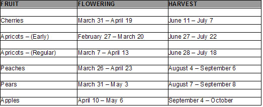
ORCHARDS IN BLOOM
While driving through Capitol Reef National Park, you will notice the variety of fruit trees in bloom. These trees consist of cherry, apricot, peach, pear, and apple. Plan to return to Capitol Reef National Park this Summer and Fall to enjoy the harvest of these fruits. The historic Fruita orchards contain over 2700 fruit bearing trees. Pick and eat all you want for free in the orchards, or take some home for a nominal fee. The orchards open to picking as optimal ripeness is reached. Refer to the chart for approximate times for flowering (which is great for photos) and you-pick harvest.
HARVEST TIME
Fruit picking is a great way for the whole family to enjoy Capitol Reef National Park. The historic Fruita orchards contain over 2,700 fruit bearing trees. Pick and eat all you want for free in the orchards or take some home for a nominal fee. The orchards open to picking as optimal ripeness is reached. Refer to the chart for approximate time for harvest.
